

By 2pm it became clear that the risk had shifted well west of the original area of east central Saskatchewan as a massive supercell cluster had become severe thunderstorm warned in the Meadow Lake region. One lonely cell appeared west of Biggar at 2:10pm in a clear area between the rain complex to the north and extreme heat in the south. Only 20 minutes later that cell exploded to nearly reach maximum heights and severe thunderstorm watches were issued shortly there after.

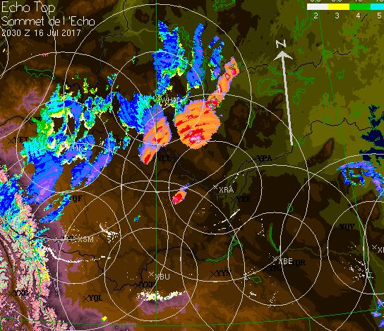
As the afternoon Severe Thunderstorm Outlook Map was being built at that time, Saskatoon and area was added to the Moderate Risk area in orange.

DALMENY AND MARTENSVILLE SK should be taking tornado precautions now. Dangerous tornado warned storm headed your way. #skstorm pic.twitter.com/sVIjxL22eL— Greg Johnson (@TornadoGreg) July 16, 2017
— Melissa Silvernagle (@msilvernagle) July 16, 2017
#skstorm just south of Langham. pic.twitter.com/3E7Kr1ihAQ— Mandy Nemanishen (@nemanishen) July 16, 2017
Photo of the day goes to Jeff Wizniak; Check his stuff out at: https://t.co/OjUTLK4vNy Tornado-warned cell near Saskatoon. Unreal. #skstorm pic.twitter.com/JWaLhRaw4i— Nick Schenher (@NickTheBody) July 17, 2017
BREAKING: Tornado warning around Saskatoon. EC says "potential tornado approaching Langham area" #skstorm #yxe pic.twitter.com/OpwCXFyLcn— Peter Quinlan (@PQuinlanGlobal) July 16, 2017
Today's tornado Warned storm chase foiled by road construction. It was a beauty of a #skstorm pic.twitter.com/MlbtOVPBPW— Jenny Hagan LostInSk (@LostInSk) July 17, 2017
Another tornado warned storm now headed straight for Saskatoon #yxe #skstorm #Sask pic.twitter.com/weBDwXh6i3— Peter Quinlan (@PQuinlanGlobal) July 16, 2017
This is a textbook tornado scenario. Next in the line of fire...Aberdeen, SK #skstorm Not a drill. pic.twitter.com/VsnuPcWEGZ— Greg Johnson (@TornadoGreg) July 16, 2017
No comments:
Post a Comment