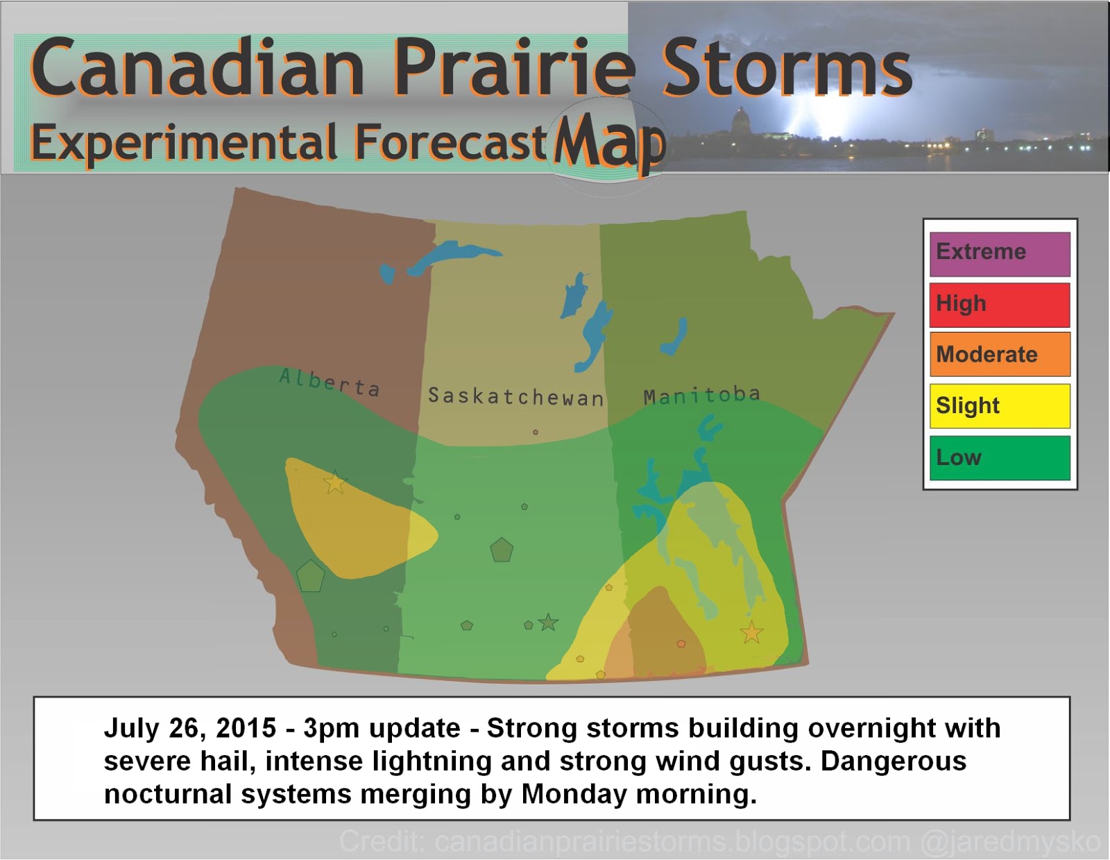
All signs are pointing to a very dangerous situation on Monday across southern Saskatchewan and southern Manitoba. Heavy rains, flash flooding, large amounts of precipitation are expected from Swift Current to Brandon starting early in the morning from nocturnal thunderstorms that may become strong to severe late tonight. Strong tornadic supercells are expected along the North Dakota/Saskatchewan/Manitoba borders early in the afternoon. Systems from Alberta will be moving quickly eastward while Manitoban storms will drop south and collect in a back-building formation in North Dakota. By early afternoon, it is expected both systems will come together over south eastern Saskatchewan with strong tornadic supercells moving north across the border from North Dakota.
Please monitor Environment Canada Warnings closely. This may become a very dangerous situation. Forecast models may change locations drastically overnight depending on how things line up. Have a safety plan ready but remember, this is only a forecast. Updates to the risk area map will be posted as required and please remember to keep reports to a workable minimum with accuracy of location and size of hail using coins or measuring device in photos. Rapid rotation reports are always best served with a short video when in a safe location.
Here is the forecast map for this evening and overnight with tomorrow's expected outlook "Day 2":